

Key Takeaways
- Zip code analysis uncovers hidden business opportunities
- Using accurate zip code data boosts targeted marketing and enhances customer understanding
- Advanced tools like ArcGIS and Tableau turn raw zip code data into actionable business insights
- Visualizations like heat maps and choropleth maps make complex geographic trends easy to grasp and act on
Introduction
From marketing to logistics, understanding the geographical distribution of your data leads to more informed decisions and targeted strategies. Zip code analysis is a powerful tool for businesses seeking insights from geographical data.
This article will guide you through analyzing business data using zip codes, helping you unlock valuable insights for strategic decision-making.
💡 Use accurate and up-to-date location data for zip code analysis. For over 15 years, we have created the most comprehensive worldwide zip code database. Browse GeoPostcodes datasets and download a free sample here.
Benefits of Zip Code Analysis
- Market Segmentation: Identify and target specific regions based on demographic and economic factors
- Sales Analysis: Track sales performance by region to identify high-performing and underperforming areas
- Customer Insights: Understand customer demographics and behaviors based on their location
- Logistics Optimization: Optimize delivery routes and warehouse locations to reduce costs and improve efficiency
Collecting and Preparing Data
Before diving into analysis, you need to collect and prepare your data. It involves gathering zip code-related data from various sources and ensuring it is clean and ready for analysis.
Data Sources
Accurate data is crucial for practical zip code analysis. Collecting the correct geographic data from different countries to Build a Standardized Zip Code Database is challenging due to varying zip code formats, making compiling consistent and usable information tough. On top of this, zip codes change often, making it resource-intensive for businesses to keep up with all these updates regularly.
💡 For over 15 years, we have created the most comprehensive worldwide zip code database. Our location data is updated weekly, relying on more than 1,500 sources. Browse GeoPostcodes datasets and download a free sample here.
Data Cleaning
Ensuring your data is accurate and consistent is crucial for reliable analysis. This process may involve:
Removing Duplicates: Eliminate duplicate records to avoid skewed results.

Correcting Errors: Fix any misspellings or inaccuracies in zip codes.
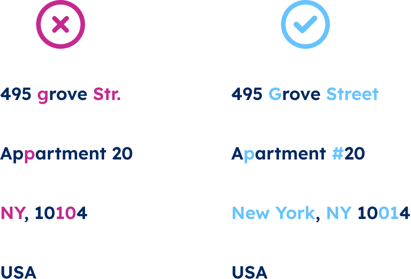
Standardizing Formats: Ensure all data is in a consistent format, such as using a standardized five-digit zip code format.
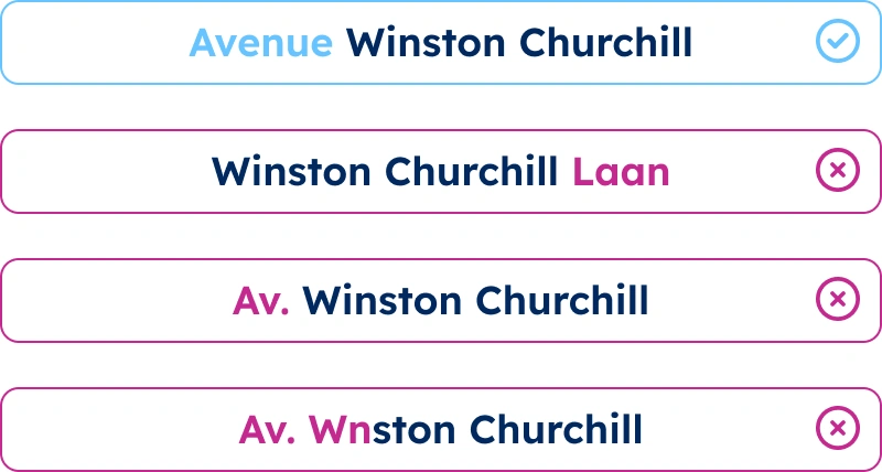
See our Address Cleaning and Address Standardization guides for an in-depth data cleaning and standardization guide.
Tools for Zip Code Analysis
Several tools can help you analyze zip code data effectively, which we listed in our article on Comparing Zip Code Mapping Tools. These tools range from simple to advanced geographic information systems (GIS). Here is an overview of some of the tools you can use to map and analyze zip codes:
Spreadsheet Applications
Microsoft Excel: Excel’s pivot tables and charting tools are invaluable for initial data exploration and visualization. You can use functions like VLOOKUP to cross-reference zip codes with external data.
Google Sheets: Offers real-time collaboration with similar functionalities as Excel, making it suitable for team-based analysis.
Geographic Information Systems (GIS)
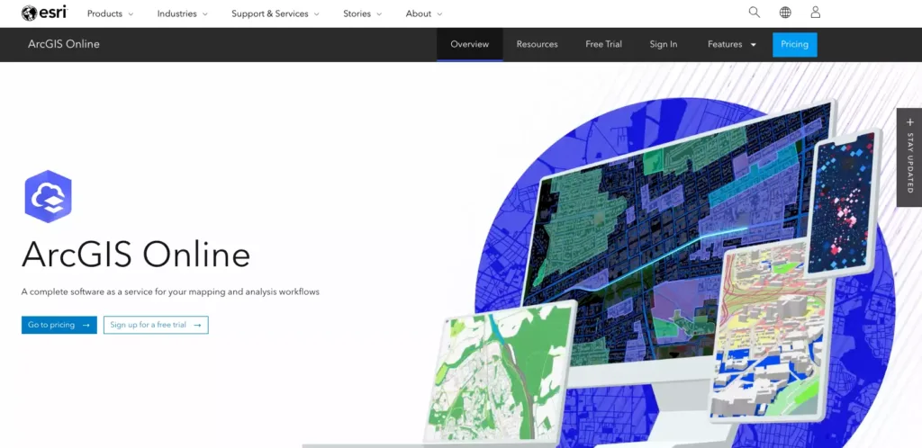
ArcGIS: This industry-standard tool provides advanced mapping and spatial analysis capabilities, enabling you to create detailed zip code maps and perform complex spatial queries.
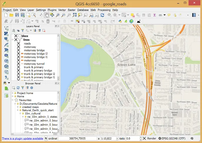
QGIS: An open-source alternative to ArcGIS, QGIS offers robust mapping tools and can handle large datasets effectively.
Business Intelligence Tools
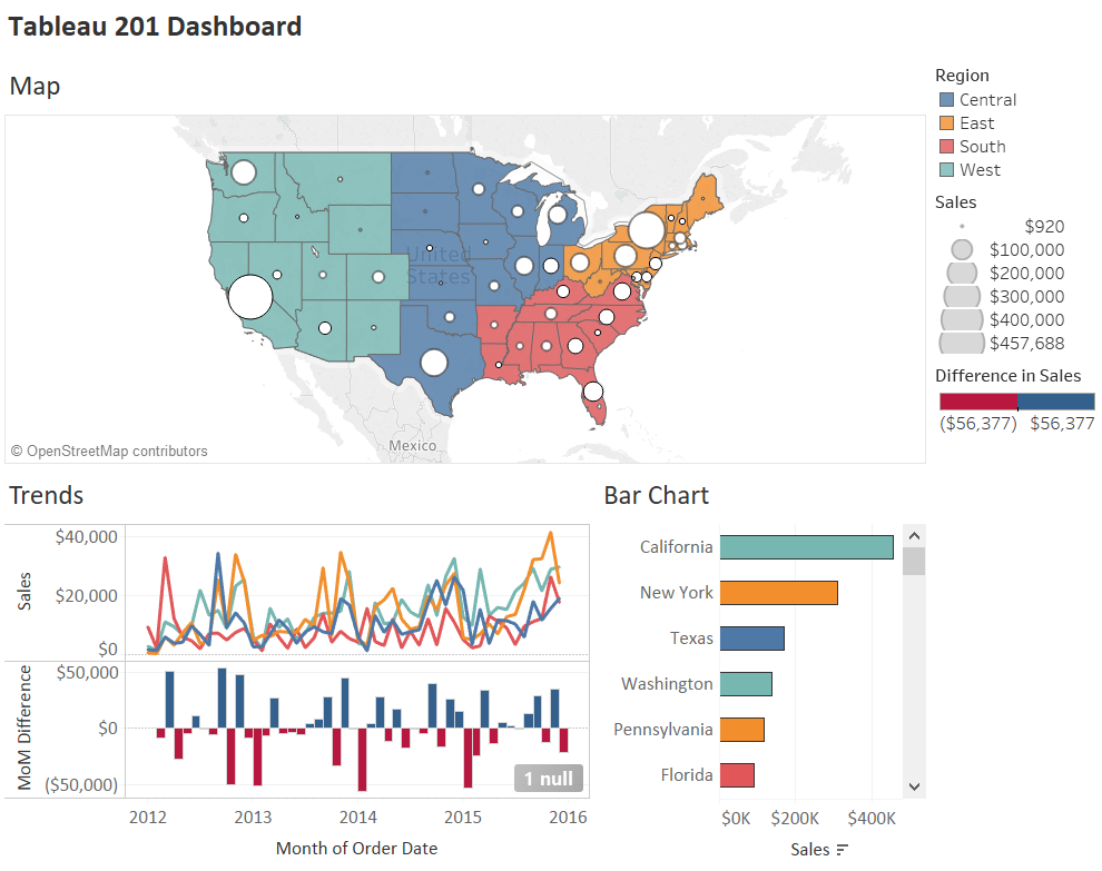
Tableau: Known for its powerful visualization capabilities, Tableau can create interactive dashboards that display zip code data in an engaging format.
Power BI: Microsoft’s Power BI integrates seamlessly with other Microsoft tools and provides comprehensive data visualization and analysis features.

If you need a simple map tool to analyze zip code data, look at our guide: How to Create Zip Code Map? Step-by-step Guide.
Analyzing Zip Code Data
Once your data is ready and you have chosen your tools, it’s time to start the analysis. Here are some examples of zip code analysis.
Sales Performance Analysis
Evaluate sales data by zip code to identify trends and patterns. It can help you understand which regions drive the most revenue and which areas need more attention.
For example, a tech company launching a new product can analyze pre-order data by zip code to identify early adopters and technology enthusiasts. The company can create a detailed profile of its most influential customers by correlating this data with social media engagement and online reviews.
It can then tailor its marketing strategies to amplify positive word-of-mouth in these critical regions, boosting overall sales and brand loyalty.
Customer Demographics
Analyze demographic data associated with zip codes to understand your customer base better. It can include age, income level, education, and more.
An e-commerce platform could integrate zip code analysis with machine learning algorithms to predict customer preferences and buying behaviors.
For instance, they can anticipate seasonal demand for specific products in different regions by analyzing purchase histories and demographic data. This predictive capability allows the platform to optimize inventory levels, reduce stockouts, and implement dynamic pricing strategies to maximize revenue.
Logistics and Supply Chain Optimization
Use zip code data to optimize your logistics and supply chain operations. For instance, you can identify the best locations for new warehouses or distribution centers based on proximity to key markets.
A global logistics company can analyze zip codes to enhance its last-mile delivery efficiency. By mapping delivery routes against traffic patterns and local infrastructure, they can develop adaptive routing algorithms that adjust in real time to avoid delays. This optimization reduces delivery times, lowers fuel consumption, and improves customer satisfaction. Furthermore, predictive analytics can forecast peak delivery periods, allowing for proactive workforce management and resource allocation.
Visualizing Zip Code Data
Visualization is a crucial aspect of zip code analysis. It helps transform complex data into easy-to-understand insights. Here are some visualization techniques.
Choropleth Maps
Choropleth maps use different shades or colors to show data values for other areas. They’re great for highlighting variations in data across zip codes. For example, population density, age distribution, or income levels can be seen. You can also track the spread of diseases or identify high and low-performing sales areas.
ArcGIS is great for creating detailed choropleth maps with lots of customization, while Tableau makes it easy with drag-and-drop features.
Heat Maps
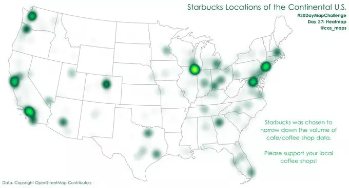
Heat maps use color gradients to show data density or intensity, making it easy to spot hotspots or patterns. They help analyze crime rates, spot regions with high customer activity or sales, and monitor pollution or wildlife activity.
You can use GeoPostcodes zip code data to create interactive heat maps on Google Maps or QGIS.
Point Maps
Point maps display individual data points on a map using markers to indicate specific locations, like addresses or landmarks within zip codes. They are perfect for optimizing delivery routes, showcasing real estate properties, and pinpointing the locations of hospitals, schools, or public offices.
Leaflet is a versatile tool for creating interactive point maps, and D3.js offers powerful customization options.
Polygon Maps
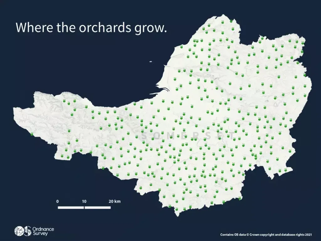
Polygon maps outline zip code boundaries and fill them with colors or patterns to represent different data sets. These maps are great for urban planning, visualizing land use, defining sales territories, and showing voting results or political boundaries.
Below is an example of a polygon map you can build using our guide on How to Build a Postal Code Polygon Database.
Bubble Maps
Bubble maps use circles of varying sizes to represent data values, making it easy to compare regions at a glance. They can be used for market research to compare market sizes across zip codes, visualize the prevalence of health conditions, and show the distribution of educational institutions.
Microsoft Power BI includes features for creating bubble maps with built-in data analysis tools, and Plotly offers interactive bubble map creation with many customization options.
Check out our guide, Geomarketing, to get detailed information on different types of zip code maps and their purposes.
Conclusion
Using geographical info, you can spot trends, optimize logistics, and fine-tune your marketing efforts for specific areas. It boosts efficiency and helps you make smarter, data-driven decisions that fuel growth and improve customer satisfaction.
Getting accurate location data for zip code analysis is tricky. Countries have different zip code formats, and keeping up with frequent updates is highly resource-intensive. Despite these challenges, reliable sources like GeoPostcodes cover these complexities, offering comprehensive and accurate data and allowing you to focus on core business operations.
Start using zip code analysis in your business today and unlock the full potential of your data. Discover how GeoPostcodes can support your business today, allowing you to concentrate on what you do best.
FAQ
What is zip code analysis, and why is it beneficial for business data?
Zip code analysis involves examining zip codes to better understand customer behaviors and market segments.
It’s beneficial for businesses as it helps uncover insights about key markets, primary customer demographics, and potential areas for growth.
How can I perform zip code analysis using Excel?
To conduct zip code analysis in Excel, utilize the Geography data type feature to transform zip codes into detailed city, state, and county data. Employ a Filled Map chart for a geographical visualization of your data.
Additionally, XLOOKUP or VLOOKUP functions are handy for linking your zip codes with an extensive database, and a Slicer can help you filter the data by specific zip codes.
What are some of the challenges and limitations of zip code analysis?
The challenges and limitations of zip code analysis include that zip codes represent mail delivery routes rather than actual geographic areas, which can change and might not accurately reflect genuine human activity or spatial trends.
Furthermore, zip codes can sometimes conceal or overlook significant local variations or developments within or across their borders, like environmental, social, or economic factors.
What are some of the best practices and tips for zip code analysis?
For effective zip code analysis, boundaries should be defined to specify territories, market segments, site locations, and marketing strategies.
However, it’s crucial to avoid treating zip codes as exact geographic areas, as they do not consistently or accurately represent real-world human behaviors.
You should organize your data into different geographic categories, such as tracts, counties, CBSAs, and zip codes, and employ the correct visualization and analysis tools.
What are zip code areas?
Zip code areas represent specific geographic regions the postal service uses to efficiently route mail.
Each zip code area typically includes multiple mailing addresses, helping streamline delivery and logistics.
Can I analyze a single zip code?
Analyzing a single zip code can provide detailed insights into that area’s demographic data, such as median household income, census blocks, and other aggregate data.
How does the United States Postal Service use zip codes?
The USPS uses zip codes to organize and expedite mail delivery.
Zip codes help identify specific regions and ensure accurate routing of mailing addresses.
What are zip code tabulation areas (ZCTAs)?
ZCTAs are statistical geographic entities created by the U.S. Census Bureau.
They approximate the delivery areas for zip codes and are used in census data to represent geographic regions accurately.
How are postal codes used in geographic analysis?
Postal codes segment and analyze regions based on various criteria, such as population density, median household income, and other socioeconomic factors.
It helps create detailed maps and reports that reflect the characteristics of different areas.
How do zip codes determine delivery routes?
Zip codes are essential in defining postal service delivery routes.
Each zip code designates a specific area; hence, the boundary of each zip code is crucial for organizing efficient mail delivery.
These boundaries help create transparent and manageable routes, ensuring timely and accurate delivery of mail and packages.