USE CASES
CO2 calculation
Reporting
PRODUCTS
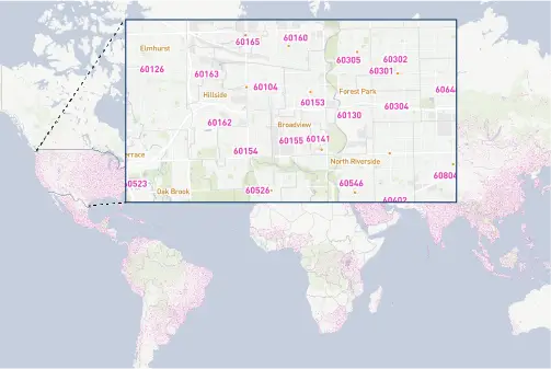
Postal database
City names
KEY BENEFITS OF LEVERAGING GEOPOSTCODES DATA
- Estimate CO2 consumption of more than 4,3 billion international freight calculations.
- Leverage a complete postal code database, including 9,2 million data points.
Powering global emission calculations with reliable zip code data
OVERVIEW
EcoTransIT (IVE Consulting Team) is the most widely used software worldwide for the automatic calculation of energy consumption, carbon emissions, air pollutants, and external costs for all modes of transport globally.
They are the market leader in compliance with the worldwide standards of carbon footprint calculation. They currently serve 320+ customers from all the logistics sectors. In the year 2024, they calculated over 4,2 million international freight transports.
We talked to Anjo Grebe, consultant at EcoTransIT, to understand how GeoPostcodes helps ensure the accuracy of their global emission calculations.

CHALLENGE
Can you explain how EcoTransit performs their emission calculations?
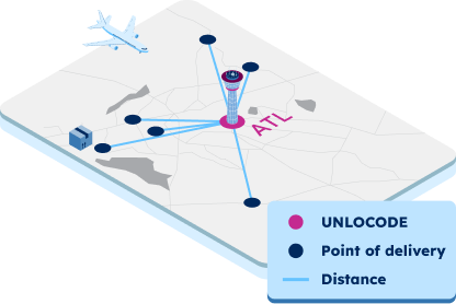
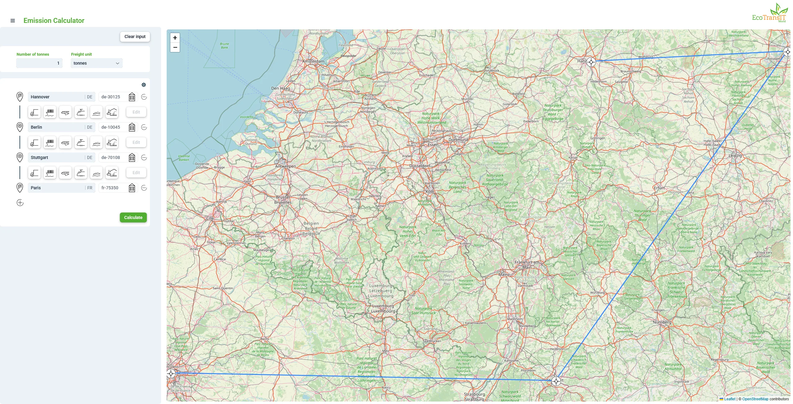
ANJO: At EcoTransIT, emission calculations begin with a routing process from origin to destination. The foundation of this process is customer-provided input, which includes key details such as freight rate, location, and transport mode (e.g., truck, train, or other options).
Locations can be provided in multiple formats, including postal codes, UNLOCODEs, station codes, IATA codes, coordinates, or city names. When shipping codes like UNLOCODEs or IATA codes are unavailable— a common scenario for many customers—postal codes and city names serve as reliable alternatives.
Once the route is established, it is divided into segments whenever a route attribute changes. This segmentation allows EcoTransIT to accurately calculate energy consumption, greenhouse gas emissions, air pollutants, and external costs.
What was your situation before GeoPostcodes?
ANJO: In the early days of EcoTransIT, location errors were a persistent issue. Users often struggled to enter the right locations, leading to frequent complaints: “Why isn’t this location available?”
To address this, we integrated GeoPostcodes’ geographical data, significantly improving data reliability. Additionally, we introduced a tool that allows customers to add new locations directly on their servers, reducing errors and enhancing the overall user experience.
SOLUTION
How does GeoPostcodes data integrate into your system?
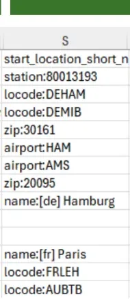
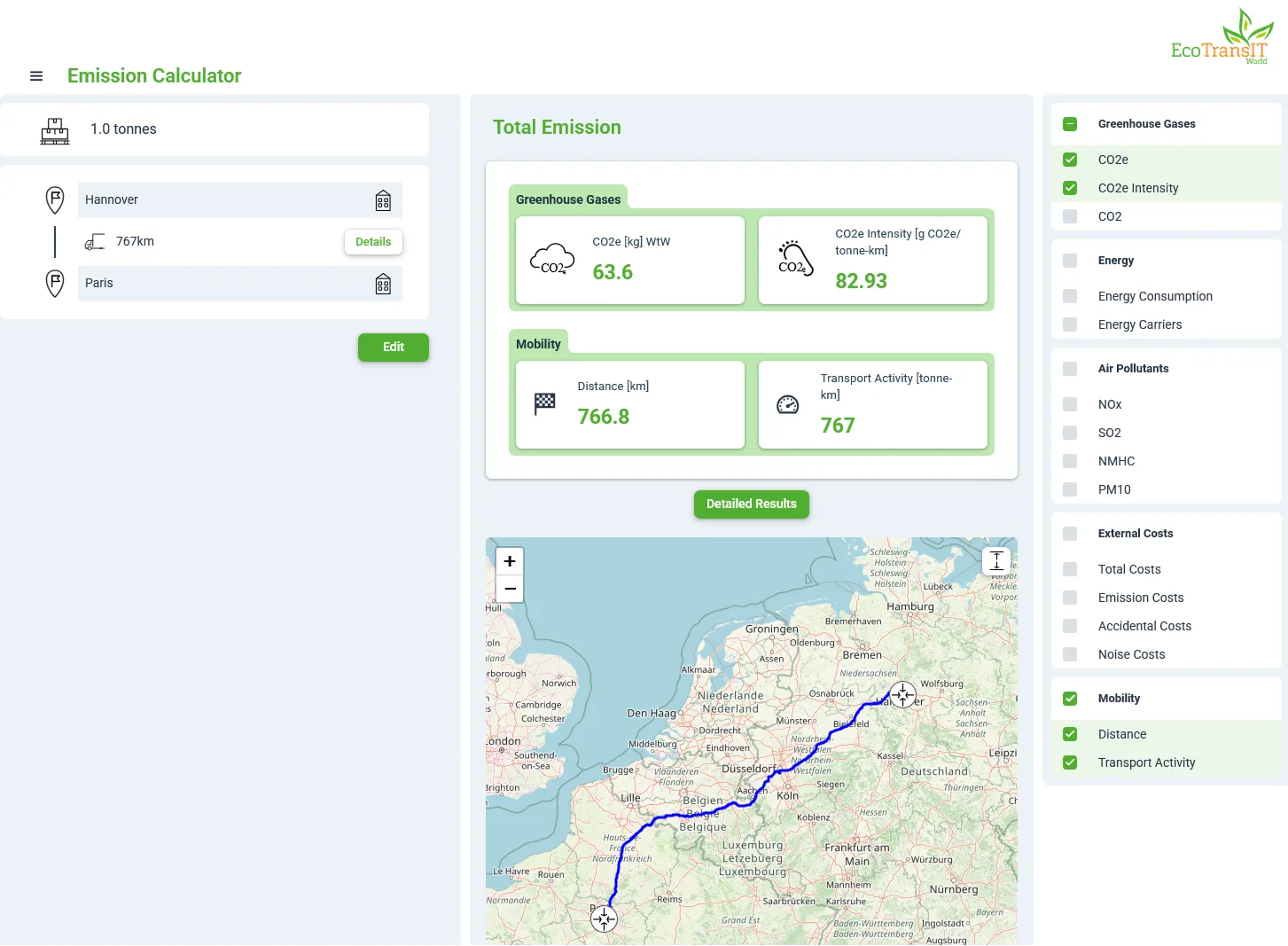
ANJO: With GeoPostcodes, we access a database of 9,2 million ZIP codes, each mapped to a coordinate within our system. This allows us to determine distances accurately, which is essential for calculating emissions.
Customers also have the ability to add their locations. They can see every default assumption we make for carbon footprint calculations, including location data, and modify it if needed. If a customer can’t find a specific location—a station code, UNLOCODE, or ZIP code—they can update it directly on their server.
How do you leverage the zip code and city data in your computations?
ANJO: Since many customers don’t have exact coordinates, our developer assigns a midpoint for each ZIP code or city as the reference point.
When a customer requests an emissions calculation, we determine the coordinates of the starting and destination locations using GeoPostcodes’ data. If only a city name is provided—like “somewhere in London”—we take the city center as the reference.
If someone says he wants to ship parcels from Hamburg to Copenhagen, we link our database with GeoPostcode’s data and estimate the distance between the two city coordinates.
Why would you say GeoPostcodes data is important in your operations?
ANJO: Without GeoPostcodes, we would not have reliable postcode data, and therefore no accurate distances for our emissions calculations. The GeoPostcodes database, with 9,2 million data points, is reference data in the background that is crucial to the accuracy of our system’s calculations.
Our consultants did a lot of research, and GeoPostcode was by far the most detailed, accurate, and cost-effective solution for us.
Thanks to the up-to-date GeoPostcodes database, we no longer have problems with missing locations, making our system much more efficient and reliable.
CONCLUSION
For EcoTransIT, reliable zip code and city data are the foundation of accurate emissions calculations.
By integrating GeoPostcodes’ global database, they have eliminated location errors, ensuring reliable distance measurements and carbon footprint assessments. With access to 9,2 million data points, EcoTransIT can seamlessly map global transport routes, enabling customers to confidently calculate emissions.
The ability for users to modify and add locations further enhances accuracy and flexibility. Thanks to GeoPostcodes, EcoTransIT continues to set the standard for emissions tracking, supporting supply chain sustainability on a global scale.
Discover how GeoPostcodes can support your distance and CO2 emission calculations. Get a personalized demo now.