Thank you for your interest in the UK data sample
Want to access our global download center?
Start your 14-day free trial and browse through our postal database, download more countries’ samples, and access our Map Explorer section. No credit card required.
124 of the Fortune 500 rely on our international postal code databases


SOLUTIONS
Get the right data for your use case
Address Capture and Validation
Map and Visualization
Reporting and Business Intelligence
Master Data Management
Rely on a single source of truth to scale the quality of your location data. Ensure accuracy, consistency, and timeliness across your systems and organization.
Logistics and Supply Chain
Design and optimize your distribution network, plan your pick-up and drop-off locations, reduce costs and improve visibility over your shipping.
Market Research and Geomarketing
Segment your respondents and customers, design sales areas for site selection, retail analytics, and targeted campaigns.
Custom Package
We help you build a solution for your use-case.
Master Data Management
Logistics and Supply Chain
Sales and Marketing
Custom Package
Frequently Asked Questions
The GeoPostcodes’ Postal database covers the whole world with a standard structure. It includes data from all other countries than USA, which USPS covers. USPS does not deliver an exhaustive database of addresses nor postal codes in the USA, but only tools to verify postal codes or addresses.
Other vendors collect USPS information and resell it. The GeoPostcodes Postal database differs from that USA data by all the features and services detailed above, for instance, the multi-lingual support, the geocodes and the timezone information.
A ZIP Code is a numerical system consisting of 5 digits utilized by the United States Postal Service (USPS) to facilitate the sorting and delivery of letters to their intended destinations. The term “ZIP” stands for “Zone Improvement Plan.”
In other countries, the terms “postal code”, “postcode” or “pin code” are also used. ZIP code data plays a crucial role in various business operations within the United States, serving as a vital parameter for mailing, fraud detection, and demographic research tasks.
The size of a ZIP code database can vary depending on the level of detail and the amount of information it contains. A 5-digit ZIP codes database and their corresponding city or location names would typically be relatively small in size, usually measured in kilobytes (KB) or megabytes (MB).
However, more comprehensive ZIP code databases can include additional data such as coordinates, county names, state codes, and other geographical attributes. These databases can grow significantly in size, ranging from several megabytes to gigabytes, depending on the extent of information they provide.
A billing ZIP code is a numerical code to identify the location of the address associated with a credit or debit card. When making a purchase or transaction online or in person, merchants often require customers to provide their billing ZIP code as a security measure to verify the authenticity of the card.
By matching the provided billing ZIP code with the one associated with the card on file, merchants can reduce the risk of fraudulent transactions.
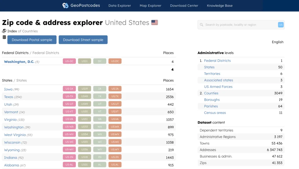
As of today, there are more than 40,000 ZIP codes in the United States. Please note that ZIP codes can be added, modified, or removed over time due to population changes, urban development, and other factors.
While “postal code” and “ZIP code” generally refer to the same concept in the United States, be aware that the terminology and format may differ in other countries. The term “postcode” is common in the United Kingdom, Australia, the Netherlands, and Germany, while “postal code” is generally used in the rest of the world, such as in Asia. In India, the most common term used is “pin code”.
The five-digit ZIP code represents delivery points throughout the United States (incl. PO boxes) and is composed of three main parts: the National Area, Region or City, and Delivery Area. Additionally, USPS has divided the entire country into 10 ZIP Code areas, numbered 0-9, starting from the northeast. The first digit of the ZIP code indicates the state to which the mailer should be sent.
A ZIP Code is a postal code used by the USPS to identify specific mail delivery areas.
It denotes precise geographic locations for mail sorting and delivery. ZIP Code Tabulation Areas (ZCTA) are statistical entities created by the Census Bureau (American Community Survey) based on aggregating census blocks sharing the same predominant ZIP Code. It’s used for census data reporting and demographic analysis.
In essence, a ZIP Code refers to a postal area for mail delivery, while a ZCTA is a statistical approximation of that area used for census and data analysis purposes.
For the past 15 years, we’ve mapped the world ZIP codes, saving you the effort. Over the years, we’ve gathered valuable knowledge, enabling us to create the most complete and accurate ZIP codes database files in the world. We use 1,500 different data sources and update our database 3 times a week.
Our databases are available through an annual license. This license covers the full right to use our data. It also includes full access to product updates and support. Our Enterprise and Product Licenses also come with several days of integration help included.
The cost of our database depends on the geographical coverage your use case requires. Additional datasets can also be included.
To receive additional information and an offer tailored to your needs, please contact us via our request quote page.